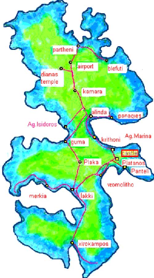
leros

Map of Leros

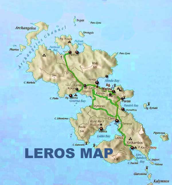
Leros is a mountainous and green island, with high hills and many small coves and villages. Its area is 53 km2 and it has 71 km of coastline. The municipality includes several uninhabited islets, including Levitha and Kínaros, and the sparsely populated island of Farmakonísi. In the 20112 census it has a population of 8,000, although this figure increases to over 15,000 during the summer period.

On the map of leros we can see its main ports, Lakkí for ferries (on the west coast) and Agía Marína for catamarans and high speed boats (in the east coast). The main town, Platanos is dominated by a magnificent Byzantine fortress recently restored, enriched with a church The other villages are Aghia Marina Panteli, Xirokambos, Partheni, Álinda, Kamara and Gourna

Location of Leros

Leros located in the southeastern Aegean Sea. It belongs to the Dodecanese group of islands and is situated between the islands of Patmos and Kalymnos. Here’s some detailed information about its location:

Geographic Coordinates: Leros is located approximately between 37.15° to 37.19° North latitude and 26.80° to 26.94° East longitude.

Relative Position: It lies southwest of Patmos and northeast of Kalymnos, with a distance of about 17 kilometers (11 miles) from each.

Dodecanese Islands: Leros is part of the Dodecanese archipelago, which consists of 12 major islands and numerous smaller ones, located in the southeastern Aegean Sea.

Proximity to Turkey: Leros is relatively close to the southwestern coast of Turkey, with the nearest point on the Turkish mainland being around 15 kilometers (9 miles) away.

Transportation: The island is accessible by ferry from various ports in Greece, including Piraeus (the port of Athens) and neighboring islands like Kos and Rhodes. Additionally, Leros has a small airport, Leros Municipal Airport, which offers domestic flights from Athens and other Greek cities.

Terrain and Size: Leros has a varied terrain, with rocky hills and fertile valleys. It covers an area of approximately 53 square kilometers (20 square miles) and has a coastline of around 71 kilometers (44 miles).

Administrative Division: Leros is part of the South Aegean region of Greece and is administratively a municipality within the Kalymnos regional unit.

Location of the island on a large scale map of Greece

leros-map
LEROS MAP

HAND MADE MAP OF LEROS

leros-map
LEROS MAP